Issued: 5:27 PM | Sunday, 6 July 2025
From: Bureau of Meteorology
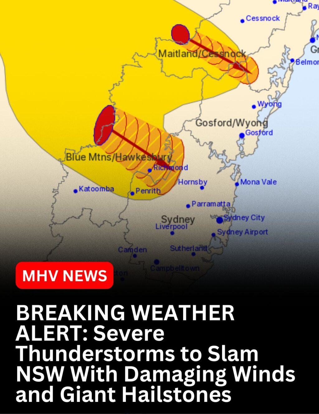
A powerful line of severe thunderstorms is sweeping across parts of NSW, with the Bureau warning of damaging winds and large hailstones threatening communities from the Blue Mountains to the Hunter and Sydney regions.
At 5:25 PM, dangerous storm cells were detected near Yengo National Park (southwest of Wollombi) and the Glen Davis/Newnes area (north of Lithgow). The storm front is moving southeast, placing several regions at immediate risk.
⚠️ Expected Impact Areas and Timing:
- By 5:55 PM: Bilpin, Colo Heights, Wollombi, and Wollemi National Park
- By 6:25 PM: Richmond, Windsor, Riverstone, and Londonderry
💥 What to Expect:
- Sudden, powerful wind gusts
- Large, potentially destructive hail
- Lightning and heavy rainfall
📣 SES Urgent Safety Advice:
- Move vehicles undercover or away from trees
- Secure outdoor items and furniture
- Stay well clear of fallen powerlines (report to your electricity provider)
- Unplug electrical appliances
- Avoid using phones during the storm
- Remain indoors and keep children and pets safe
🆘 For emergency help, contact SES on 132 500
📻 Updates also available via radio, TV, and www.bom.gov.au
🚨 Next Warning Due by 6:30 PM
Stay alert. Stay safe. This is a dangerous weather situation, and immediate precautions should be taken.
#NSWStorm #ThunderstormWarning #BOM #HunterWeather #SydneyStorms