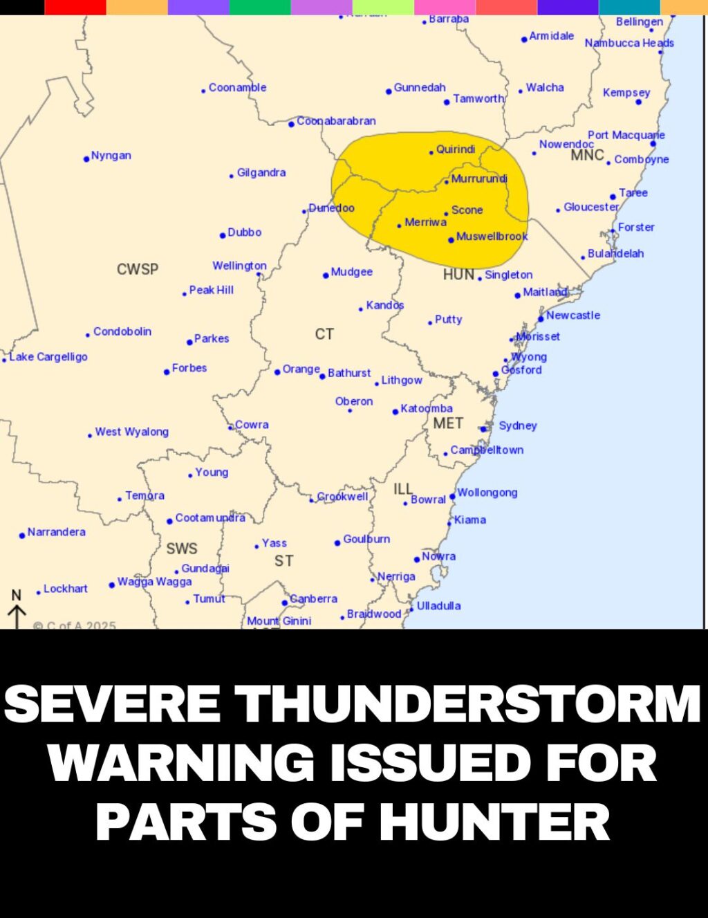
A severe thunderstorm warning has been issued for parts of the Mid North Coast, Hunter, Central Tablelands, North West Slopes and Plains, and Central West Slopes and Plains Forecast Districts, including areas such as Scone, Barrington Tops, Muswellbrook, Merriwa, Murrurundi, and Quirindi.
Issued at 11:22 am on Tuesday, 11 February 2025, the warning highlights the threat of heavy rainfall, which may lead to flash flooding. Severe storms, which began in inland parts, are slowly moving east and are expected to persist through the morning. Further storm development is anticipated later this afternoon, particularly over eastern and northern areas of the state.
The Bureau of Meteorology reports that 38mm of rainfall was recorded at Merriwa in the hour leading up to 10:25 am. These severe storms are expected to continue affecting the region over the next several hours.
Safety Advice from the State Emergency Service:
- Stay clear of creeks and storm drains.
- Never walk, ride, or drive through floodwater.
- If trapped by flash flooding, seek higher ground and call 000 for rescue.
- Be cautious of rapid run-off in areas affected by previous bushfires, as it may contain debris and increase the risk of landslides.
- Unplug electrical appliances and avoid using phones during the storm.
- Stay indoors, away from windows, and ensure children and pets are kept inside.
- Stay vigilant and monitor changing conditions, especially in areas impacted by bushfires.
For assistance during floods and storms, call the SES on 132 500.
A follow-up warning is expected to be issued by 2:25 pm. Stay tuned to TV, radio broadcasts, and the Bureau’s website at www.bom.gov.au for the latest updates.